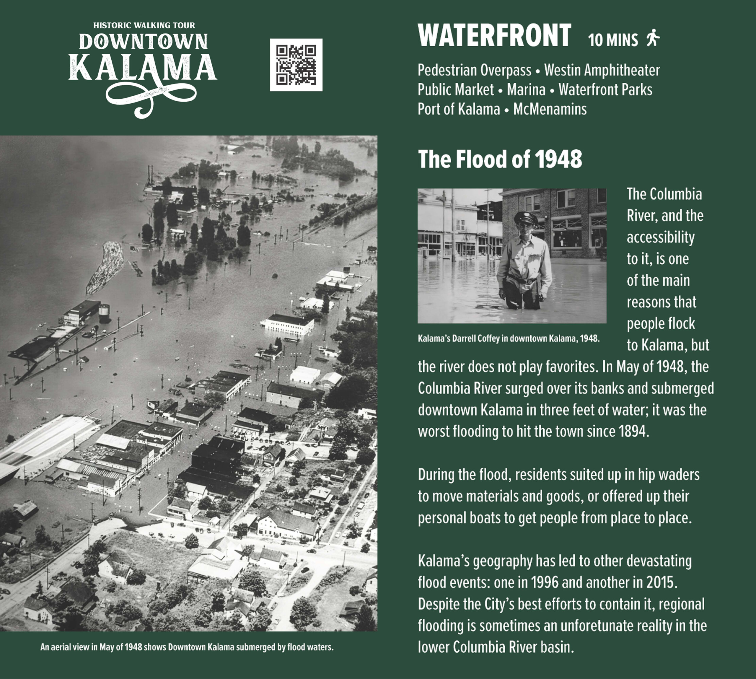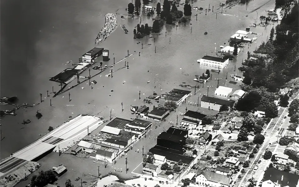
Floods
The accessibility of the Columbia River, along with its rich array of natural resources, has historically drawn settlers to the Kalama region, establishing it as a primary factor influencing the decision for many to reside there. Nevertheless, the river is impartial in its behavior, periodically subjecting the community to significant challenges, particularly in the form of flooding, a consequence of the town’s location within the lower Columbia River basin. The most catastrophic incident took place in May 1948, marking the most severe flooding event since 1894. During this disaster, the river overflowed its banks, inundating downtown Kalama with approximately three feet of water, as levels surged dramatically, destroying roads, homes, and businesses—only one house at the northern end of the town remained unscathed. In response to the crisis, residents adapted by wearing hip waders to transport essential goods or utilizing personal boats for mobility. Subsequent devastating floods occurred in 1996 and 2015, serving as stark reminders to the community that, despite ongoing mitigation efforts, flooding remains an intermittent yet formidable reality.